Chronology of Border Changes
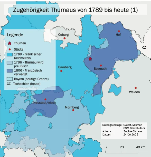
1699 The Counts of Giech acquire the blood jurisdiction for the territory of Thurnau from the Margraviate of Bayreuth and thereby claim for Thurnau, that it was an independent territory, only subordinate to the Emperor in the Holy Roman Empire of German Nations.
1796 Thurnau becomes Prussian and, in contrast to Bamberg, which was occupied by France during the revolutionary wars, remains under Prussian protection until…
1806 Thurnau is occupied by France in the year of the dissolution of the Holy Roman Empire. In the Peace of Tilsit in 1807, Prussia ceded Thurnau to Napoleon as part of the Principality of Bayreuth.
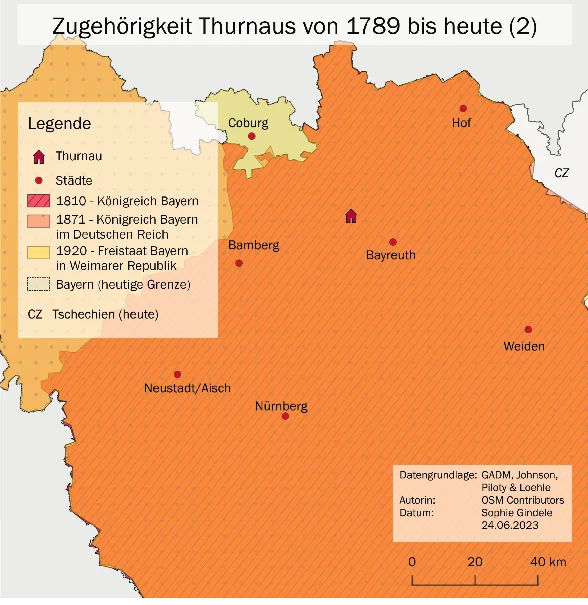
1810 Thurnau is given to the Kingdom of Bavaria through the Treaty of Paris - and thus is part of the Confederation of the Rhine till 1913. Thurnau retained the lower jurisdiction until 1848.
1828 Bavaria signs the South German Customs Union, which is merged into the German Customs Union in 1934.
In 1837, the districts named after river names based on the French model were replaced by tribal names in order to establish identification with the new Bavarian state: (Upper) Main region became (Upper) Franconia.
1866 Thurnau is now just below the southern border of the North German Confederation.
1871 Thurnau becomes part of the German Empire proclaimed in Versailles,
1884 German Colonialism
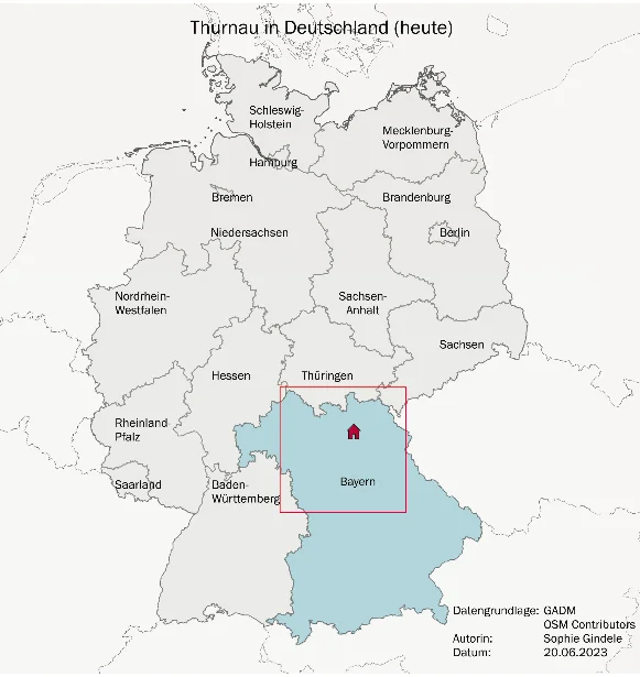
1919 Thurnau is now within the Free State of Bavaria in the new borders of the Treaty of Versailles. The northern border of Bavaria shifts and includes Coburg from 1920.
1933 The new NS Gau “Bavarian Ostmark" is introduced as a spatial concept to signal a well-fortified border region to Czechoslovakia, which was founded after the First World War.
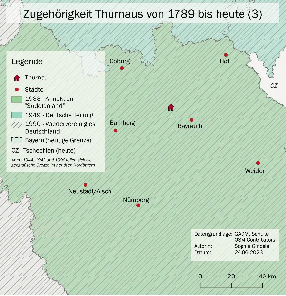
1938 "Anschluss" of Austria and annexation of the "Sudetenland".
1939-45 Since the "Ostmark" was no longer the border area as a result of the German policies of conquest and occupation in World War II, it was renamed "Gau Bayreuth" in 1942. The designation disappeared after World War II.
1945 Thurnau is liberated by the Americans and remains in the American Zone.
1949 In the new Federal Republic, Thurnau is located in the so called “Zone border area” with the Iron Curtain.
1951 Germany is a founding member of the European Union.
1989/90 Fall of the Berlin Wall and German Reunification
1992 Bavaria's border with Czechoslovakia becomes the border with the Czech Republic
2004 With the EU admission of Estonia, Latvia, Lithuania, Malta, Poland, Slovakia, Slovenia, the Czech Republic, Hungary and Cyprus and the accession of Romania, Bulgaria (2007) and Croatia (2013) and the exit of the United Kingdom (2020), the EU external border shifts. Thurnau is now in the "heart of Europe" and, thanks to the Schengen Agreements that have been passed since 1985, is in the largest visa-free zone in the world.
References
Literature:
Thurnau – 1239 bis zum Ende des Alten Reiches. Ersch. in: Markt Thurnau (Hrsg.): Thurnau 1239-1989. Bayreuth, 1989. S.9-16.
Humphreys, Nicola: Der Fränkische Kreistag. 1650-1740. Würzburg, 2011.
Authors: Wolfgang Ficht